


Explore this interactive map by turning on additional layers in the Filters below, and by moving and zooming in and out of the map to find areas of interest. Icons on the map link to more information about the area or region selected. Filter layers can be turned off and on in any combination. To learn more about each layer, please see the Legend below the map.

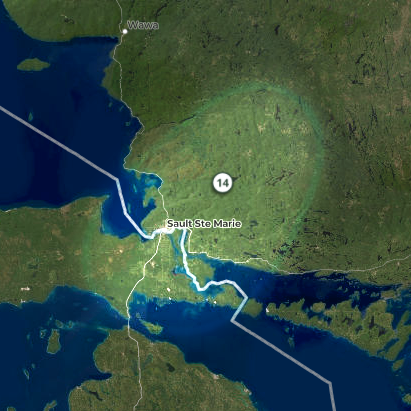
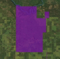
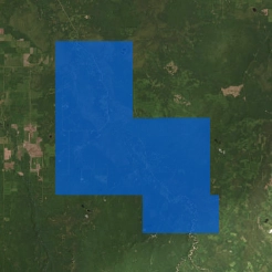
National Priority Areas for Ecological Corridors (NPAEC) are places where restoring or conserving connectivity is most needed in Canada. NPAECs are not corridors themselves, but priority areas for creation of ecological corridors. There could be many individual corridors with each priority area. In other words, they are areas where ecological corridors are most needed when looking at the vast landscape.
Data source: Parks Canada
Dive into the interactive and in-depth StoryMaps created by Canadian Geographic Education. New StoryMaps are created throughout the year, so sign up to our newsletter to be notified.
Ecological corridors are one of the tools in the nature conservation toolbox. They are most useful where natural habitats are highly fragmented by human use. In the northern regions of Canada, human impact is much lower, and habitat fragmentation is very low. In those places, protecting large intact blocks of land might be a better conservation strategy than ecological corridors.
Data source: Locke et al (2019)
Methodology: Parks Canada.
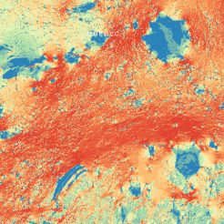

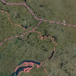
This layer represents a measure of how probable it is for an animal to move through a certain area. Cities and farms are risky for animals to move through and therefore less likely to be used by wildlife than forests or other natural habitats. High probability, shown as orange and red on the map, means that the area could be important for animal movement across landscapes.
Data source. Areas Important for Ecological Connectivity Throughout Canada
Scientific paper Predicting areas important for ecological connectivity throughout Canada (2023)
Data source: First Nation Reserve (2020)

This data was drawn from the 2016 Census, and the criteria for determining a “significant” population are as follows:
- First Nations: > 2000 people
- Métis: > 1000 people
- Inuit > 200 people
Explore stories of ecological connectivity and corridor projects from coast to coast to coast through in-depth reporting by Canadian Geographic. New stories are added throughout the year, so sign up to our newsletter to be notified.
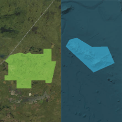
Protected areas safeguard biodiversity, ecosystems and ecosystem services by reducing stresses from human activities. They can also provide opportunities for people to connect with nature. Protected areas include national, provincial and territorial parks, Indigenous protected areas, national wildlife areas, migratory bird sanctuaries and marine protected areas.
Data source: Canadian Protected and Conserved Areas Database (2023)
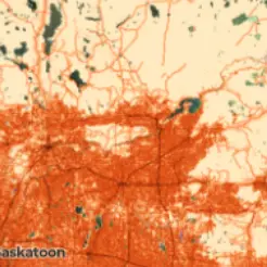
The human footprint is a measure of how strong an impact humans have on the land. Cities, industrial sites and farms have a high human footprint, while protected areas and natural habitats have low human footprint. Areas with high human footprint are places where ecological corridors are most useful as they increase the likelihood of safe passage across areas of high human development.
Data source: The Canadian Human Footprint (2022)

Treaties are agreements made between the Government of Canada, Indigenous groups and often provinces and territories that define ongoing rights and obligations on all sides. Treaties with Indigenous peoples include both historic treaties with First Nations and modern treaties, also called comprehensive land claim agreements with Indigenous groups. The boundaries shown here delineate the final negotiated area of each treaty or land claim.
Data source: Modern Treaties (2023)
Historic Treaties (2022)
Data source: Métis Settlement (2024)
